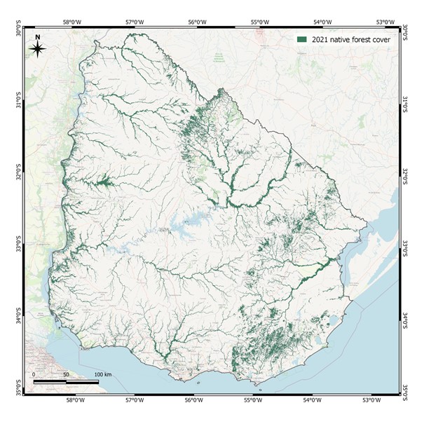
Native Forest Data
The National Forest Cartography of native forest for the year 2022 was prepared by the General Forestry Directorate (DGF) of the Ministry of Livestock, Agriculture and Fisheries (MGAP) and the National Directorate of Climate Change (DINACC) of the Ministry of Environment (MA).
Sentinel 2 images were used and processed in Google Earth Engine. The product was the Native Forest Cover for the year 2021. For the selection of the scenes, the period between the months of October 2021 and February 2022 was taken as a reference.
Native forest cover in Uruguay.